We gather and interpret spatial data so you can build better
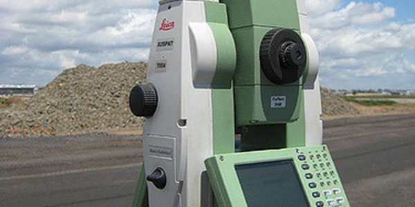
Survey Equipment
As surveyors we are highly trained to carry out measurements with advanced expertise that have to be backed by the finest, most exacting technical equipment available. The surveying profession has become highly reliant on computing and technology to produce reliable and effective data. At Latitude 91 we choose to use Leica Geosystems survey equipment, it gives us the peace of mind needed to fulfil our clients survey needs to a level of dependability they would expect. After many years of using Leica Geosystems equipment we have proven the mechanical reliability of this equipment and its ability to produce accurate and repeatable spatial measurements.
We currently use a range of fully robotic one-man total stations and GNSS units. We wouldn’t trust anything else for the important and complex tasks of positioning the high profile projects of our clients. Our upgrade policy ensures that we have the best and most effective equipment available for your spatial positioning needs.
The constantly evolving technologies associated with surveying continue to assist in the development of faster and more accurate data capture methods, resulting in a better return on investment for our clients.
Data Processing
Latitude 91 primarily uses 12D Model for survey data processing. A system we firmly believe to be the market leader for design analysis, 3D modelling, conformance reporting, plan production, processing and analysing survey data, and in its ability to interface with other software packages. We can produce easily digestible, visual representations of survey data to assist construction personnel in understanding such things as the construction processes and conformance reporting, helping minimise rework to benefit the overall project.
Data Management
Surveying is primarily about the collection of spatial information. Over the life of a project surveyors can create a large amount of data that can be worth a considerable amount of money for the client. Being able to efficiently manage, collate and reproduce this data can result in significant benefits to the project both in time efficiencies and cost savings.
Latitude 91 has designed and built its own in-house data management software and complimenting systems to manage all data coming into and going out of a survey department. We have refined this process over a number of years to make data management an easy and efficient process. At any time on any project we are able to quickly and effortlessly find, reproduce and trace the origin of all information produced from day one. Our system has been taken up by a number of projects and clients we have done work for.

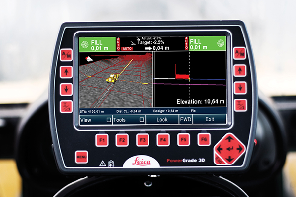
Machine Guidance Management
Data management and precise design modelling for all your machine control systems will help to seamlessly take an earthworks project from greenfield to project completion.
We can create site cut fill plans and calculate earthworks volumes aiding Site Foreman and Engineers with project planning. Volumes can be tracked to show the amount of material that has been removed or placed for progress claims.
Staff Login...

Latitude 91 | Copyright 2016